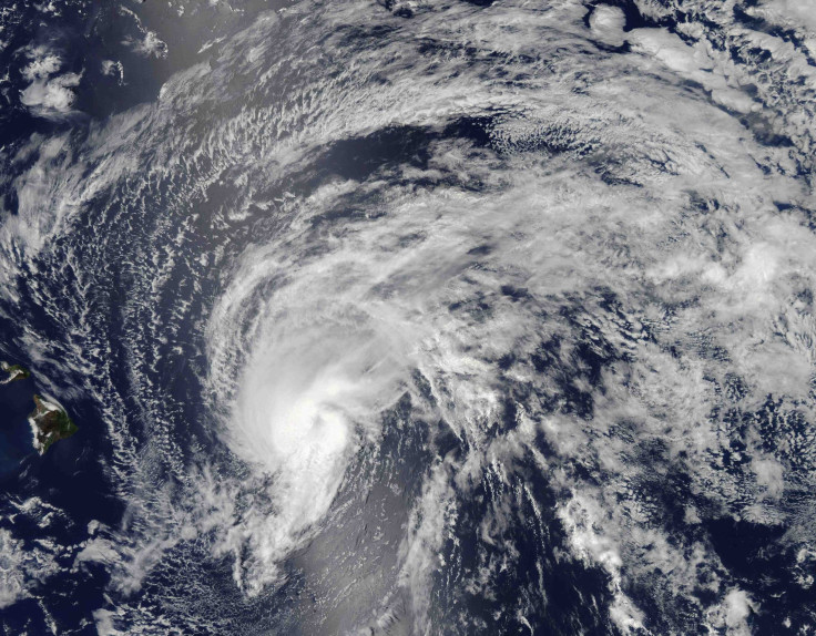
As it continues to move westward over the eastern Atlantic, Tropical Storm Erin -- the fifth named storm of the 2013 Atlantic Hurricane season -- continues to bring significant winds of around 40 miles per hour.
According to The Inquisitr, it is not known whether or not Erin will hit the eastern seaboard or simply turn away. The storms starting point was southwest of Africa's Cape Verde Islands and as it continues to move along, Tropical Storm Erin should gradually decrease in forward speed.
RELATED: Chipotle Antibiotic Free Meat? Restaurants Considering Using Antibiotic-Treated Beef
This storm will not have an immediate impact on the United States since it is more than 2,000 miles away from land, but it should still remain a focal point of those living along the Atlantic shores since the storm should continue in that general direction.
Issuing a public advisory for the Atlantic storm, the National Hurricane Center indicates that there are currently no coastal watches or warnings in effect while the storm continues to move at a speed of about 16 mph.
RELATED: World's First Twitter Hotel Is Unveiled In Spain For Social Media Lovers [VIDEO]
AT 500 AM, THE CENTER OF TROPICAL STORM ERIN WAS LOCATED NEAR LATITUDE 16.3 NORTH...LONGITUDE 30.5 WEST.
ERIN IS MOVING TOWARD THE WEST-NORTHWEST NEAR 16 MPH...26 KM/H...AND THIS GENERAL MOTION IS EXPECTED TO CONTINUE WITH A GRADUAL DECREASE IN FORWARD SPEED DURING THE NEXT COUPLE OF DAYS.
MAXIMUM SUSTAINED WINDS ARE NEAR 40 MPH...65 KM/H...WITH HIGHER GUSTS. SOME SLOW STRENGTHENING IS FORECAST DURING THE NEXT
48 HOURS.
TROPICAL STORM FORCE WINDS EXTEND OUTWARD UP TO 35 MILES...55 KM FROM THE CENTER.
NOAA also notes that there are currently no hazards affecting land.
With this being the fifth official storm in what is expected to be an active hurricane period, the official Atlantic Hurricane season began on June 1 and runs through Saturday, November 30.


© 2025 Latin Times. All rights reserved. Do not reproduce without permission.


